Future Now
The IFTF Blog
Citizen Sensing
After Fukushima, no city-wide radiation data existed—until thousands of volunteers collaborated to build the world’s biggest global radiation database
 When the Fukushima 9.0 earthquake, tsunami and subsequent nuclear radiation disaster hit Japan in March 2011, survivors were desperate to know how much radiation was leaking into their environment. Residents of the Fukushima area immediately needed to know if it was safe enough to stay, or if they had to pull their kids out of school and move at jet speed to another city. Unfortunately, the Japanese government—just like any other government on the planet—wasn’t set up to measure radiation on a city-wide level. Likewise, no private agency had any data. If people wanted answers, they’d have to gather the radiation data themselves. Here’s a story of how collaborative science by regular folks created the biggest radiation database our world has ever had.
Immediately after the Fukushima earthquake hit, Sean Bonner, co-founder of the first hackerspace in Los Angeles and visiting researcher with MIT Media Lab’s Center for Civic Media, pinged his friend Joi Ito to see how their mutual friends in Japan, including Ito’s family, were faring. Ito, the Director of the MIT Media Lab, wasn’t in Japan at the time, so they both began reaching out to anyone who might have information. They contacted their friend, Pieter Franken, who was living in Tokyo, working at the Keio University as a senior visiting researcher, and within hours the three of them had formed a giant Skype chat room where a bunch of people were attempting to exchange information—especially about Fukushima’s radiation levels.
At first, the group just assumed this data was available. “We thought, okay, we’re Internet people. We can find this information,” recalls Bonner. “Then we were shocked and horrified to learn that no, there actually wasn’t any information available anywhere because there were no sensors in place. There was nobody monitoring it in any way.”
Rather than remain helpless, they were determined to fix this problem. Their first strategy was to buy a bunch of Geiger counters and give them out to people. A week or so after the earthquake they launched a Kickstarter to do this, but very quickly realized that this plan wouldn’t work—the world supply of Geiger counters had sold out within 24 hours. “The people who were selling Geiger counters…they were maybe selling 5-10 of them a month. Then all of a sudden they were getting orders for 2-3,000 a day. They couldn’t keep up,” says Bonner.
 During this same time, Bonner and Ito were supposed to hold their annual New Context Conference in Tokyo. But at the eleventh hour they restructured the event. Instead of speaking about planned topics, such as Internet startups and new technology, they shifted the entire conversation to earthquakes and brought in the people they’d been talking to in the Skype chat room. It was at this conference that they came up with a plan to take the few Geiger counters they had, add Arduinos and GPS modules to them, and attach these modified sensors to their cars.
“We were doing our first drive one month after the earthquake, and that’s when we were able to collect something like 10,000 data points on one single drive as opposed to just one or two data points walking around,” says Bonner. “As we were collecting that data, we started to see that it wasn’t different than the official data that was starting to come out, it was just incredibly more precise.” More precise because, since their sensors were mobile, they covered a lot more ground than the few static sensors the government monitored. This enabled people to see differences in radiation levels from one street to the next, rather than receiving just one reading for an entire city. Some streets were safe, others were not, which is something the officials hadn’t been able to determine.
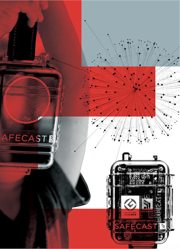
To build on this data, Bonner, Ito and Franken immediately launched Safecast, a global collaborative project that would collect radiation data with the help of ordinary citizens. The idea was to enlist volunteers to drive around with mobile Geiger counters and collect real-time radiation data that would then be uploaded to Safecast’s site. The site would display color-coded maps (different colors for different radiation levels) from any country or city in the world, and once a driver covered a neighborhood with their mobile sensor, the data would show up in color on the map.
 But since Geiger counters weren’t available, Safecast created kits to make bGeigies—mobile radiation sensors—that volunteers could make themselves and then strap onto their cars. bGeigies are pretty simple to make if you have very basic soldering skills (solderless kits will be available by the end of the year), and they take about an evening to build.
Just months after the earthquake, volunteers began collecting radiation data by driving the streets of Fukushima—and beyond. Safecast openly shared this data (which is released under a CCO public domain designation so that anyone can use it for free) on their website. “Our religion is open data,” Bonner says.
Right away it was obvious that Fukushima evacuation centers were in the wrong neighborhoods. The Japanese government confirmed Safecast’s findings and changed their evacuation routes. “People stopped going to the Japanese government for their information. Our data was growing so much faster,” says Bonner. “Pretty quickly, our data became the de facto source.”
Not only did volunteers continue to collect radiation data in Japan, but volunteers started popping up all over the globe, collecting 10 million data points after Safecast’s first two years. Volunteers have collected data from much of the United States, Europe, and other parts of Asia. Chernobyl and other nuclear sites have also been covered. And volunteers aren’t just science geeks. “We have everything from high school kids to retirees collecting data. We have nerdy dudes to mothers groups in Japan,” says Bonner.
So what inspires regular folks to fork out $600 US for a bGeigie kit (many people share them), build the sensor, and then drive around to collect data? For those living near nuclear disaster sites the reasons are obvious. They want to know if their city is a safe place to live. This is why Japanese mothers make up the largest group of Safecast volunteers. But for people living in much lower-risk parts of the world, Bonner thinks there are two main motivators that get people involved, and they aren’t mutually exclusive.
First, Safecast is a cool project, and people want to be involved with something cool going on. They can have fun with the build, they can have fun collecting data, and then they can see their work on Safecast. They can point to their color-coded drives on Safecast’s map and say, “I collected that.” The second reason is that people want to be part of an important cause. They want to help their community or their world. It’s a way to get involved.
Fast forward to five years later. Thousands of citizens from around the globe have collected over 50 million data points for Safecast, breaking all records of radiation data collecting. “It’s now the largest radiation data set that’s ever existed,” says Bonner. “All the other data sets combined are still smaller than this data set.”
 And Safecast continues to grow. Besides their constantly expanding radiation data set, the organization is also working on air sensors so that people can measure the size of air particulates. They just had their first run of prototypes.
By being public domain and completely transparent, their data, which has been endorsed by the U.N., has benefited scientists and academics who previously only had access to radiation data that they collected themselves on a budget. “The reception has been incredibly positive because researchers and academics have never had access to this kind of data before,” says Bonner. “It’s been revolutionary for them in a lot of ways.”
Although Safecast now refers to their collaborative data gathering as “citizen sensing”, others might use the more popular term, “citizen science”. By taking the process of data collection out of the hands of bureaucrats and officials and offering this process to the people, information becomes accessible, science drives forward, and we all benefit. In other words, a collaborative effort by regular folks using smart technology and the Internet equals more knowledge and thus empowerment for everyone. And this allows us to make smarter decisions.
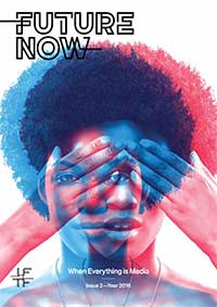 FUTURE NOW—When Everything is Media
In this second volume of Future Now, IFTF's print magazine, we explore the future of communications. In our research process, we traced historical technology shifts through the present and focused on the question, “what is beyond social media?”
Think of Future Now as a book of provocations; it reflects the curiosity and diversity of futures thinking across IFTF and our network of collaborators. It contains expert interviews, profiles and analyses of what today’s technologies tell us about the next decade, as well as comics and science fiction stories that help us imagine what 2026 (and beyond) might look and feel like.
For More Information
For more information on IFTF's Future 50 Partnership and Tech Futures Lab, contact:
Sean Ness | sness@iftf.org | 650.233.9517


